
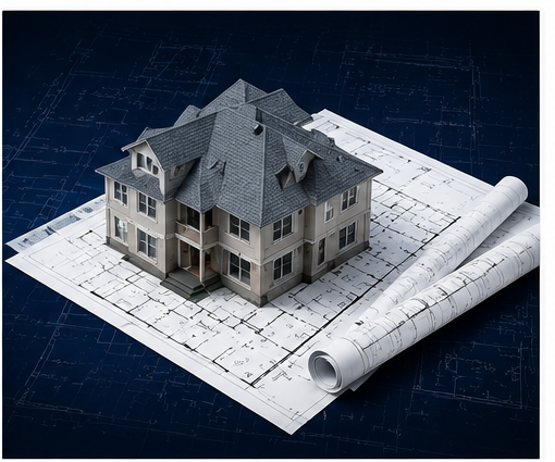
Why Accurate Property Documentation Matters
When teams work from bad measurements or outdated drawings, projects go sideways fast. Inaccurate data at the start creates a ripple effect that costs money, time, and trust.
Bad measurements create:
- ✕Inaccurate contractor bids — estimates miss the real scope
- ✕Design mistakes that don't match the actual space
- ✕Project delays when field conditions don't match drawings
- ✕Costly rework after construction has already begun
- ✕Permit rejections due to incorrect submitted plans
TruePoint captures accurate existing conditions the first time — so your team can move faster, bid smarter, and build with confidence.
What You Get Instead
Laser-measured floor plans
Dimensionally accurate to within 0.5–1% using LiDAR scanning — not a tape measure and guesswork.
As-built CAD floor plans
DWG files your architect or contractor can work directly from, no manual re-drawing required.
Renovation documentation
A complete record of existing conditions before any work begins — critical for scope control and change orders.
Revit-compatible 3D model deliverables
Architectural survey data prepared for use in Revit-based design and coordination workflows.
Real Deliverables
Download Sample Files
These are actual output files from a real iGUIDE capture — the same types of files you'll receive. Download and open them in AutoCAD, Revit, or any compatible viewer.
CAD Floor Plans
Multi-floor DWG floor plans with room dimensions and area totals. Standard & above.
Exterior Elevations
Front, rear, left, and right building elevations drafted in DWG format.
Roof Plan
Roof plan with slopes, edges, and overhang dimensions in DWG.
Reflected Ceiling Plans
Bulkheads, lighting fixtures, and ceiling height indicators — all floors.
Full Advanced Drawing Package
Complete set: all floor plans, elevations, roof plan, ceiling plans, and LiDAR DXF point cloud.
3D Revit Model
Walls, doors, windows, and structural elements in Revit RVT + DWG format.
Sample files are from a real residential property capture. File types and structure match exactly what you'll receive.
Documentation Packages
From a basic measured floor plan to a full as-built CAD and 3D model package — choose the level of detail your project requires.
Standard
Floor plan + 360° tour for renovation planning
- iGUIDE 360° virtual tour
- Laser-measured floor plan
- PDF blueprint (room dimensions & area totals)
- ANSI Z765-compliant measurements
- Shareable online iGUIDE link
- ✕CAD/DWG file export
- ✕Roof plan or elevations
- ✕3D Revit-compatible model
Advanced CAD
Most popular for architects & contractors
- Everything in Standard
- CAD floor plan (DWG) — LOD 200, AIA layers
- LiDAR point cloud (DXF)
- Roof plan (DWG with slopes & edges)
- Exterior elevations (front, rear, sides)
- AutoCAD & Revit compatible
- ✕3D Revit-compatible model
Full Development
Complete as-built documentation package
- Everything in Advanced CAD
- 3D Revit-compatible model deliverable (walls, doors, windows, structure)
- Reflected ceiling plan
- Interior LiDAR point cloud data
- Xactimate/ESX compatible export
- Contractor & developer-ready documentation
Pricing varies by property size and complexity. Contact us for a custom quote on large or complex properties.
One Visit. Everything You Need.
Our property measurement services use the iGUIDE PLANIX camera system — LiDAR laser scanning combined with 360° imaging — to capture every room, every measurement, and every angle in a single appointment.
The result is a complete architectural survey of the existing conditions. PLANIX LiDAR scanning typically achieves dimensional accuracy within approximately 0.5%–1% under normal site conditions — suitable for contractor bids, renovation planning, and professional architectural drawings.
From that single scan we deliver as-built floor plans, PDF blueprints, CAD floor plans (DWG/DXF), Revit-compatible 3D model deliverables, and interior LiDAR point cloud data — depending on the package you choose. It's existing condition documentation your entire team can act on.
What You Can Do With This Data
Hand your architect an accurate DWG as-built — skip manual measuring
Get more accurate contractor bids with real dimensions
Provides accurate existing-condition documentation often used during renovation planning and permit preparation
Share a 360° tour with your team remotely
Process insurance claims with Xactimate-compatible ESX files
Create marketing materials with accurate square footage
Who Uses Existing Condition Documentation?
Accurate as-built data is valuable any time you need to know what's really there before you start planning, building, or bidding.
Renovation & Remodeling
Give your contractor a CAD floor plan and stop paying for hours of manual measuring. Start the design process from accurate, as-built data.
Architects & Designers
As-built DWG files give you a precise starting point for renovation drawings, addition plans, or interior redesigns.
Real Estate Investors
Evaluate rehab scope, plan renovations, and share accurate property data with your team — all from one site visit.
Property Management
Maintain a digital record of every unit with accurate floor plans and 360° tours for marketing, maintenance, and tenant handoffs.
Insurance & Restoration
Document pre-loss or post-loss conditions with spatial accuracy. ESX files are Xactimate-compatible for claims processing.
Historic Preservation
Capture existing conditions of historic buildings with laser accuracy before any restoration work begins.
Request a Quote
Tell us about your property and what you need. We'll follow up with custom pricing — usually within one business day.